A city is a large settlement in terms of population and geographic size. Its totality of economic, utility, residential and engineering facilities determines the formation of a special environment for the life and activities of city residents. One of critical issues urban planning - types and features of city planning, the diversity of which can be reduced to two fundamentally different patterns: radial and checkerboard.
Ring arrangement of settlements
Chronologically, this principle of building construction began to be used later than the rectangular intersections of streets characteristic of linear systems. In plan, such a structure has a round shape with a concentric structure. Its skeleton is formed by the intersection of radial lines in a common central space, connected by ring streets.
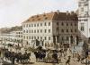
A classic example of circular development is Moscow; in a modified version, the concentric structure is characteristic of other European capitals - Paris, Vienna, Berlin and Brussels. With the advantages of compactness and ample room for seamless expansion, radial city layout has a number of negative features:
- as the territory grows, peripheral areas become increasingly distant from each other and from the main life support zones concentrated in the central part;
- the inevitability of congestion of traffic flows in the center, causing widespread development of traffic difficulties both within the city and beyond;
- difficulties with the reconstruction and/or modification of highways due to the density of buildings in the city core;
- the presence of a “bottleneck” effect - a phenomenon associated with a strong narrowing of a multi-lane highway, which leads to a decrease in highway capacity and additional waste of time changing lanes of traffic;
- difficult to solve ecological problems air pollution from automobile and industrial emissions caused by the lack of space for public gardens, parks and other recreational areas with green spaces.
There is a problem, there is a solution
There is an established opinion among Moscow motorists that distances in the Russian capital are measured not in kilometers, but in hours. This is not surprising, since Moscow traditionally occupies a leading position in the world in terms of the length of time spent traveling between districts.
Statistics show that on average, city residents spend approximately 1.5 - 2 hours in traffic jams every day, and during peak periods, losses can amount to over a dozen hours. This situation shows that the already built ring lines are not able to relieve traffic flows. Therefore, other methods must be used.
In the world, the problem of radial-ring planning is being solved by launching new and expanding the functionality of existing branches of urban transport, building underground and above-ground communications, and modernizing highways. Replacing the rings with separate chords, arranged to overlap each other, has worked well.
All these methods are actively being developed and implemented in Moscow. The city electric train has already started operating on the Small Ring of the Moscow Railway. Due to the impracticality of constructing the Fourth Transport Ring, small lines are being built to connect the largest outbound highways. In the most heavily loaded parts of the street network, reverse traffic is organized.
Checkerboard layout of large cities
Externally, this type of structure of a settlement represents the intersection of avenues at right angles, as a result of which separate blocks of approximately equal size. A regular structure based on the intersection of two overland trade routes arose in ancient times; it can be observed in the policies of ancient Egyptian, ancient, and Asian civilizations.
On modern stage typical example - layout of the city of St. Petersburg, the foundations of which were laid by Peter the Great. Other representatives of this type of urban planning are Beijing, Chicago, Almaty. A variation of the chess type is the ribbon system, when the development of the street network proceeds along one direction due to a geographical obstacle: mountains, rivers, gorges. The example here is Volgograd, whose length is over 100 km.
Advantages and disadvantages
In contrast to the previous type of layout, the main advantage of the chess variety is the uniform distribution of traffic flows. The consequence here is the absence of a distinct central zone, leading to a more uniform distribution of the most important objects throughout the city.
The chess organization provides unlimited opportunities for the growth of a locality, but in major cities regular rectangular buildings, it is often easier to reach the neighboring block on foot than by car. A large number of street intersections increases the mileage of private and public transport, and also requires great responsibility in matters of traffic regulation with traffic lights.
In its pure form, radial or checkerboard urban planning is rare. As a rule, the type of urban geometry used in urban planning is determined by the natural features of the location of the object. Thus, in the presence of a mountain range or sea coast, a linear scheme is advantageous; when a city is located near a river bend, a radial-ring development often develops.
Abstract on Moscow studies
"Folding the radial-ring layout of Moscow"
student of 9 "D" class of school No. 1061
Demenkova Ilya.
Moscow. 1997
1. Introduction. Layout of Moscow.
2) History of folding rad.-col. Moscow layouts:
a) Economic and geographical location of ancient Moscow and the Kremlin;
b) China Town;
V) White City and Zemlyanoy Gorod;
d) Kamer-Kollezhsky Val;
e) Circular railway;
3) Features of Moscow in connection with its layout.
4) Problems and Prospects.
Introduction.
One of the most important factors influencing the development of the capital Russian Federation, the city of Moscow is its layout - radial-ring or branch-fan. This layout is typical for ancient European cities and represents a structure similar to that shown in Fig. 1:
This layout is beneficial for settlements that simultaneously perform the roles of a transport-industrial hub and a military-tactical center, which were the majority of ancient Russian cities, not excluding Moscow, with the only difference being that Moscow performed more of a transport function, since it was originally located at the intersection several trade routes, and later itself became a major transport hub.
The radial-ring planning system is a synthesis of the radial layout, ideal for transport hubs (Fig. 2) and the classical chain of fortifications (Fig. 3).


Fig.2 Fig.3
The undoubted advantages of the radial-ring layout include its compactness, speed of intra-city movement and unlimited growth opportunities in everyone directions. The main disadvantage of this layout is the inevitability of traffic congestion in the central part of the city.
Along with Moscow, classic examples of radial-ring planning are cities such as Paris and Vienna. It is less pronounced in Berlin and Brussels.
The current radial-ring layout did not take shape in Moscow right away. How the structure of Moscow developed over the centuries is described in the second paragraph.
History of radial-circular folding
Moscow planning.
The prerequisites for the formation of a radial-ring structure appeared in Moscow initially, from the moment the city was founded. The reason for this was that Moscow was founded at the intersection of several trade routes: Torzhok-Tver-Moscow-Ryazan, Uglich-Tver-Moscow-Kursk, etc. But in those days Moscow was not yet “round”, that is, it did not have a radial --ring layout: the Kremlin walls - from the first wooden ones to those erected by Ivan Kalita - looked like a triangle, located on a cape between the Moscow and Neglinnaya rivers. A small trading town, such as Moscow at that time, had neither the opportunity nor the need to overcome any obstacles to its growth, especially water ones.
On the contrary, the river provided better protection than many fortress walls, and it would have been unwise to settle beyond its line. Even after building strong stone walls, which consolidated the size of the Kremlin, the city continued to grow mainly to the east, where at the beginning of the 16th century, under Ivan Kalite, the wall of Kitai-gorod arose, which included the settlements that arose during the first Kremlin walls into the city.
But the moment came when Moscow grew so large that first the small Neglinnaya and then the large Moscow River ceased to be an obstacle to its growth. Two new lines of city fortifications, erected in late XVI century, recorded the gradual rounding of the city's boundaries. The first line - the walls of the White City - resembled a strongly curved horseshoe, the ends of which rested on the Moscow River. The wall that ran along the river connected the ends of the horseshoe with the walls of the Kremlin and Kitay-Gorod. In general, the White City was almost a complete ring. When its walls were broken down a hundred and fifty years later, wide boulevards were laid out in the vacant space. Together they make up, then what we now call the Boulevard Ring.
And the first completely closed ring around the city was formed by the walls of Zemlyanoy Gorod, which “stepped over” the Moscow River, covering Zamoskvorechye. Now the famous Garden Ring lies on the site of the walls of Zemlyanoy City.
The next ring of the “city fence” - Kamer-Kollezhsky Val - was built in mid-18th century century, no longer for defensive purposes, but as a customs border of the city - the rampart limited the territory in which the alcohol monopoly of tax farmers, who acquired the right to exclusive trade in alcohol within Moscow, operated. This “ring” was about 37 km long irregular shape. It retreated especially far from the center to the northeast, where the important and populous suburbs of Preobrazhenskoye and Lefortovo lay, and in the northwest and southwest it came close to the center, as if it was “pressed in.”
Kamer-Kollezhsky Val actually became the border of the city, but the tsarist government did not recognize this for a long time. For example, in 1806 it was announced that the Moscow city police could control the entire Kamer-Kollezhsky Val, but the Garden Ring was still considered the official border of the city. The Moscow Duma many times appealed to the government with a request to establish a border corresponding to the true size of the city, but every time she was refused. The opportunity to establish new city boundaries appeared only in 1917.
By this time, another ring had arisen around Moscow - the Circular Railway. It was not intended for urban traffic and very poorly corresponded to the real boundaries of the city, but, nevertheless, it was recognized as the official border of Moscow. The ring road became a kind of feature that summed up the growth of the city over seven and a half centuries - until the October Revolution.
But within six months the Duma was replaced by the Moscow Council, and it was forgotten within the city’s borders for a long time.
They remembered this issue only in the late 20s - early 30s.
And so, in 1935, a grandiose Master Plan for the development and reconstruction of Moscow was developed. Similar Plans were created later - in 1971, for example - but they were rather a continuation of the thoughts set out in the 1935 General Plan. The plan was supposed to identify promising directions for the development of the capital and prevent spontaneous, unorganized development. He proposed “preserving the historical layout of the city and simultaneously introducing new elements into it” - such as long straight avenues (mainly in the southern part of the capital) and large green areas. In accordance with the Plan, a Central semi-ring was laid along the borders of the Kremlin and Kitai-Gorod, consisting of a chain of squares connected by wide avenues. The Garden Ring was expanded and improved along its entire length, and transport interchanges were built at intersections with radial highways. Work began on the construction of the Third and Park rings. The war prevented the full implementation of the Plan, but separate areas rings were built. Later, in the 1971 General Plan, the idea of relieving the Center from traffic flows received further development. It seemed that a correction to the age-old flaw in Moscow's planning scheme was just around the corner, but this did not happen. Laying new streets among the existing buildings, constructing numerous transport interchanges - tunnels, overpasses, bridges turned out to be a long and expensive task. In addition, the implementation of the work encountered stubborn resistance from “zealots of antiquity”, who denied any possibility of reconstructing old Moscow streets.
True, Moscow did receive one new ring. It became the Moscow Circle highway(MKAD), built at the end of the 50s as a high-speed highway, all the crossings of which were arranged on different levels. Initially, this 109-kilometer ring was intended only to allow transit vehicles to bypass the city, but today its role for intra-city traffic has greatly increased.
Moscow has long gone beyond the Moscow Ring Road, but it served as the administrative border of Moscow for a whole quarter of a century.
Features of Moscow in connection with its layout.
"Rings" around Moscow in different times were erected for different purposes: those built before the Kamer-Kollezhsky Wall were fortifications, after - attempts to relieve the Center from traffic. In general, the issue of traffic congestion in the central part of the city in cities with a radial-ring layout is very acute. For example, the center of Paris handles a flow of 15,000 cars every day during rush hour. In Moscow the situation is almost worse.
But Moscow also has some pleasant features: for example, the radial-ring layout contributed to the architectural diversity of the capital. The Moscow metropolitan region is one of the most popular recreational areas in the world, and it owes this not to any individual attractions, but to the layout of Moscow.
Moscow quickly overcame the only obstacles on its way - the Neglinnaya and Moskva rivers, so the advantages of the radial-circular layout were most fully demonstrated - you can quickly move around the city, which is especially noticeable when using the metro. By the way, the Moscow metro is unique in its own way; its layout is practically the only one that has such a pronounced radial-ring structure.
In general, the main feature of Moscow is that
that it most strongly expressed the features of a radial-ring layout.
QUESTION 21. BASIC DIAGRAMS OF URBAN STREET ROAD NETWORKS AND THEIR REFLECTION.
Classification of city streets and roads.
1. Radial.
2. Radial-ring.
3. Rectangular.
4. Rectangular-diagonal.
5. Triangular.
6. Free.
7.Combined.

 Radial. This pattern is mainly found in old cities. Disadvantage: poor communication between peripheral areas (all roads go through the center). Advantages: good connection with the center. The scheme is applicable in small towns.
Radial-ring. The same radial scheme, but with the addition of ring highways. The number of ring highways depends on the size of the city. Ring highways relieve significant congestion from the center and create convenient connections between districts. However, in large cities, traffic along ring directions located closer to the center leads to congestion. This scheme partially eliminates the disadvantages of the radial one. Disadvantage: ring roads are unevenly congested.
 |
Rectangular. This diagram represents a system of parallel perpendicular streets. Used in “young” cities. Advantages: simplicity and the ability to distribute transport throughout the city. Disadvantage: long routes between diagonally located areas. With an elongated shape of the city, this diagram turns into a rectangular-linear one.
 |
|
 Rectangular-diagonal. This is a rectangular layout with the addition of diagonal directions. Advantages: simplicity and improved communication between diagonally located peripheral areas. Disadvantage: a large number of intersections, and at the intersection one of the streets intersects at an angle of 90º (≈ 45º). It complicates the organization of traffic flow and the placement of buildings.
 Loose and triangular. found in the historically established conditions of old cities. A large number of nodes are formed with the intersection of many highways under acute angle Disadvantage: a large number of intersections at an acute angle. Not applicable in newly built cities.
 |
Combined. It is a combination of two or more schemes, found in large cities, where in old areas it is radial-ring, and in new areas it is rectangular. This scheme is used to increase throughput and eliminate the shortcomings of the simplest schemes.
When considering transport network diagrams, they are compared using the straightness coefficient. The distance, travel time and convenience depend on this coefficient. For the main types of planning schemes, the coefficient of non-straightness is:
Rectangular with a square design – 1.41;
Rectangular – 1.27;
Radial-ring (with 12 radii) – 3.86;
Triangular – 1.1.
Streets settlements are divided into:
1. Expressways
2. main streets and roads (citywide and regional significance)
3. streets and roads of local importance (residential, industrial and municipal-warehouse areas, driveways; village streets, pedestrian roads)
Expressways have a considerable length and are designed to connect with highways of the general network and for high-speed transport links between remote areas of settlements.
Trunk streets and roads of citywide importance are designed to connect with expressways and roads of the general network, as well as to connect remote areas with the center.
Trunk streets and roads of regional significance are intended for transport connections within residential and industrial areas between themselves and the main streets of citywide significance.
Residential streets serve for transport and pedestrian connections between residential neighborhoods and main streets.
Streets and roads of industrial and municipal-warehouse areas serve for transport and pedestrian connections of individual industrial enterprises and warehouses with main streets.
The driveways are intended for transport communications within microdistricts, as well as for access to individual facilities in industrial areas.
Pedestrian roads are intended for traffic in residential areas, for connections with places of work and recreation, stopping points, and public centers.
Village streets serve for transport and pedestrian connections within villages, as well as for connections with industrial zones and highways
Trunk streets and roads form the basis of the city's road network. These are communication routes that provide passenger and freight connections between functioning zones of the city.
Depending on the scale of connections, main streets and roads are of citywide and regional significance.
Depending on the composition of the movement, they are divided into 3 groups:
1. predominantly with passenger traffic
2.mainly with freight traffic
3 mixed traffic
Depending on the speed of movement, main streets and roads are divided into:
1. adjustable
2. with continuous traffic
3. With high-speed traffic, local streets and roads form the basis of the planning structure of individual areas. Serve for direct connection of individual objects. Must have access to main streets and roads.
Abstract on Moscow studies
"Folding the radial-ring layout of Moscow"
student of 9 "D" class of school No. 1061
Demenkova Ilya.
Moscow. 1997
1. Introduction. Layout of Moscow.
2) History of folding rad.-col. Moscow layouts:
a) Economic and geographical location of ancient Moscow and the Kremlin;
b) China Town;
c) White City and Zemlyanoy City;
d) Kamer-Kollezhsky Val;
e) Circular railway;
3) Features of Moscow in connection with its layout.
4) Problems and Prospects.
Introduction.
One of the most important factors influencing the development of the capital of the Russian Federation, the city of Moscow, is its layout - radial-ring or branch-fan. This layout is typical for ancient European cities and represents a structure similar to that shown in Fig. 1:
This layout is beneficial for settlements that simultaneously perform the roles of a transport-industrial hub and a military-tactical center, which were the majority of ancient Russian cities, not excluding Moscow, with the only difference being that Moscow performed more of a transport function, since it was originally located at the intersection several trade routes, and later itself became a major transport hub.
The radial-ring planning system is a synthesis of the radial layout, ideal for transport hubs (Fig. 2) and the classical chain of fortifications (Fig. 3).


Fig.2 Fig.3
The undoubted advantages of the radial-ring layout include its compactness, speed of intra-city movement and unlimited growth opportunities in everyone directions. The main disadvantage of this layout is the inevitability of traffic congestion in the central part of the city.
Along with Moscow, classic examples of radial-ring planning are cities such as Paris and Vienna. It is less pronounced in Berlin and Brussels.
The current radial-ring layout did not take shape in Moscow right away. How the structure of Moscow developed over the centuries is described in the second paragraph.
History of radial-circular folding
Moscow planning.
The prerequisites for the formation of a radial-ring structure appeared in Moscow initially, from the moment the city was founded. The reason for this was that Moscow was founded at the intersection of several trade routes: Torzhok-Tver-Moscow-Ryazan, Uglich-Tver-Moscow-Kursk, etc. But in those days Moscow was not yet “round”, that is, it did not have a radial --ring layout: the Kremlin walls - from the first wooden ones to those erected by Ivan Kalita - looked like a triangle, located on a cape between the Moscow and Neglinnaya rivers. A small trading town, such as Moscow at that time, had neither the opportunity nor the need to overcome any obstacles to its growth, especially water ones.
On the contrary, the river provided better protection than many fortress walls, and it would have been unwise to settle beyond its line. Even after the construction of strong stone walls that consolidated the size of the Kremlin, the city continued to grow mainly to the east, where at the beginning of the 16th century, under Ivan Kalite, the wall of Kitai-Gorod arose, incorporating into the city the settlements that arose during the first Kremlin walls.
But the moment came when Moscow grew so large that first the small Neglinnaya and then the large Moscow River ceased to be an obstacle to its growth. Two new lines of city fortifications, erected at the end of the 16th century, recorded the gradual rounding of the city's borders. The first line - the walls of the White City - resembled a strongly curved horseshoe, the ends of which rested on the Moscow River. The wall that ran along the river connected the ends of the horseshoe with the walls of the Kremlin and Kitay-Gorod. In general, the White City was almost a complete ring. When its walls were broken down a hundred and fifty years later, wide boulevards were laid out in the vacant space. Together they make up, then what we now call the Boulevard Ring.
And the first completely closed ring around the city was formed by the walls of Zemlyanoy Gorod, which “stepped over” the Moscow River, covering Zamoskvorechye. Now the famous Garden Ring lies on the site of the walls of Zemlyanoy City.
The next ring of the “city fence” - Kamer-Kollezhsky Val - was built in the middle of the 18th century not for defensive purposes, but as a customs border of the city - the shaft limited the territory in which the alcohol monopoly of farmers who acquired the right to exclusive trade in alcohol within Moscow operated. This “ring” was about 37 km long and had an irregular shape. It retreated especially far from the center to the northeast, where the important and populous suburbs of Preobrazhenskoye and Lefortovo lay, and in the northwest and southwest it came close to the center, as if it was “pressed in.”
Kamer-Kollezhsky Val actually became the border of the city, but the tsarist government did not recognize this for a long time. For example, in 1806 it was announced that the Moscow city police could control the entire Kamer-Kollezhsky Val, but the Garden Ring was still considered the official border of the city. The Moscow Duma many times appealed to the government with a request to establish a border corresponding to the true size of the city, but every time she was refused. The opportunity to establish new city boundaries appeared only in 1917.
By this time, another ring had arisen around Moscow - the Circular Railway. It was not intended for urban traffic and very poorly corresponded to the real boundaries of the city, but, nevertheless, it was recognized as the official border of Moscow. The ring road became a kind of feature that summed up the growth of the city over seven and a half centuries - until the October Revolution.
But within six months the Duma was replaced by the Moscow Council, and it was forgotten within the city’s borders for a long time.
They remembered this issue only in the late 20s - early 30s.
And so, in 1935, a grandiose Master Plan for the development and reconstruction of Moscow was developed. Similar Plans were created later - in 1971, for example - but they were rather a continuation of the thoughts set out in the 1935 General Plan. The plan was supposed to identify promising directions for the development of the capital and prevent spontaneous, unorganized development. He proposed “preserving the historical layout of the city and simultaneously introducing new elements into it” - such as long straight avenues (mainly in the southern part of the capital) and large green areas. In accordance with the Plan, a Central semi-ring was laid along the borders of the Kremlin and Kitai-Gorod, consisting of a chain of squares connected by wide avenues. The Garden Ring was expanded and improved along its entire length, and transport interchanges were built at intersections with radial highways. Work began on the construction of the Third and Park rings. The full implementation of the Plan was prevented by the war, but individual sections of the rings were built. Later, in the General Plan of 1971, the idea of relieving the Center from traffic flows was further developed. It seemed that a correction to the age-old flaw in Moscow's planning scheme was just around the corner, but this did not happen. Laying new streets among the existing buildings, constructing numerous transport interchanges - tunnels, overpasses, bridges turned out to be a long and expensive task. In addition, the implementation of the work encountered stubborn resistance from “zealots of antiquity”, who denied any possibility of reconstructing old Moscow streets.
True, Moscow did receive one new ring. It was the Moscow Ring Road (MKAD), built in the late 50s as a high-speed highway, all the barriers of which were arranged at different levels. Initially, this 109-kilometer ring was intended only to allow transit vehicles to bypass the city, but today its role for intra-city traffic has greatly increased.
Moscow has long gone beyond the Moscow Ring Road, but it served as the administrative border of Moscow for a whole quarter of a century.
Features of Moscow in connection with its layout.
The “rings” around Moscow were built at different times for different purposes: those built before the Kamer-Kollezhsky Wall were fortifications, after that they were attempts to relieve traffic congestion in the Center. In general, the issue of traffic congestion in the central part of the city in cities with a radial-ring layout is very acute. For example, the center of Paris handles a flow of 15,000 cars every day during rush hour. In Moscow the situation is almost worse.
But Moscow also has some pleasant features: for example, the radial-ring layout contributed to the architectural diversity of the capital. The Moscow metropolitan region is one of the most popular recreational areas in the world, and it owes this not to any individual attractions, but to the layout of Moscow.
Moscow quickly overcame the only obstacles on its way - the Neglinnaya and Moskva rivers, so the advantages of the radial-circular layout were most fully demonstrated - you can quickly move around the city, which is especially noticeable when using the metro. By the way, the Moscow metro is unique in its own way; its layout is practically the only one that has such a pronounced radial-ring structure.
In general, the main feature of Moscow is that
that it most strongly expressed the features of a radial-ring layout.
Problems and Prospects.
The main problem of Moscow - transport congestion in the Center - is now close to being resolved. The Moscow ring road is expanding, and more and more Moscow motorists prefer it to intracity highways.
But there will never be too few problems. Moscow is growing and soon - in a dozen or two years - there will be a need to build a new ring around the city. However, this is not given sufficient importance: the newest Moscow territories, the so-called “outbursts” outside the Moscow Ring Road, arise and grow almost spontaneously, growing in those directions in which Moscow is already “stretched” - in the northern and southern parts of the capital; there is no hint of a radial-ring layout in them. We need to think about the next ring highway now and develop “emissions” accordingly.
With the growth of Moscow and, accordingly, the complication of movement within the city, the role of the metro will have to increase. And the moment will come when the Circle Line of the metro, roughly corresponding to the Garden Ring, will no longer be enough. The same situation is observed here as with “emissions” - they have not yet thought about a new ring and are building “branches” of the metro without taking into account the fact that soon - in 50-60 years - it will become necessary.
In general, after solving the problem of transport congestion in the Center, the main issue in the development of the capital of the Russian Federation, the city of Moscow, will be the planning of new urban areas.
List of used literature .
1) Moscow. Encyclopedia. 1980
"Soviet Encyclopedia", 1980
2) "Moscow. Man-City-Nature. Experimental tutorial for high school.
Rogachev A.V. "Bustard", 1994
If functional zoning reflects, first of all, differences in the nature of use various parts city, then the planning structure of the city is expressed in relative position main functional areas and the system of connections between them. The planning structure of a city largely depends on the size and construction of the city’s transport structure. Transport infrastructure not only fixes the planning structure of the city, but also largely determines its subsequent development.
When designing a city, it is necessary to identify its “framework”, the territory of the most intensive development and concentration of the most important functions, usually associated with the city center and main transport routes. The “framework” is the most consistent basis in time for the spatial planning organization of the city. In a generalized form, it fixes the geometry of the plan and thereby predetermines the trends in the further territorial development of the city.
It is necessary to take into account that the elements of transport infrastructure are rigidly fixed in space, and this rigidity is higher, the higher the communication class. In principle, three types of city planning schemes can be distinguished: radially- ring yu, chess And free(Fig. 2.2).
Rice. 2.2. City planning schemes: A- radial-ring; b- chess; in - free
Radial-ring(concentric) scheme contains two fundamentally different types highways - radial and ring.
Radial highways serve to connect the city center with peripheral areas, and ring streets connect radial streets and ensure the transfer of traffic flows from one radial direction to another. This layout allows the development to be harmoniously located around the center, where the main objects of public and business development are concentrated (concentrated). With this layout you can easily get to the city center. The advantage of the radial-ring scheme is the compact shape of the plan, in which the natural environment of the city is least disturbed.
Chess The scheme, in which the streets intersect at an angle of 90°, assumes a relatively uniform development of the territory. This type of planning structure has been widely used at all times. The advantage of the chess structure is the possibility of uniform distribution of traffic flows. With this layout, it is easy to demarcate areas.
However big number street intersections increases vehicle mileage and lengthens trips. The checkerboard pattern makes it difficult to form a clearly defined central core and system of centers of residential areas of the city.
Linear (tape) the scheme is a kind of checkerboard layout, strongly elongated in one direction. Objects in the central part of the city in this case are located along the main highway or along several parallel highways. Linear diagram provides proximity to the natural environment and other transport routes. This layout allows for convenient transport links, reducing travel costs. However, as the city grows and the development zone lengthens, a significant part of the territories turns out to be too far from the centers of various ranks. In addition, the distances between in separate parts cities.
In some old cities, the central part may consist of quiet and crooked streets that do not have a clear geometric pattern. This scheme is called free.
Basic principles of city planning organization:
Flexibility of the planning structure, ensuring unhindered development of the city;
Differentiation of transport routes;
Organization effective system service;
Creation of the city’s environmental infrastructure, including a different system of green spaces;
Efficient and economical equipping of the city with all types of engineering equipment;
Compositional requirements for the city plan (development of the city center, district centers in the city, creating an attractive silhouette of the city and ensuring visual perception of its main natural and architectural dominants).
With all the features of the planning structure, formed on the basis of the considered transport schemes, taking into account the real situation, in cities (especially large and large ones) fundamentally different territories can be identified according to the location of zones within the city.
City center - a relatively small central area of the city, in which there are areas of administrative buildings, cultural and business facilities, green areas, squares, pedestrian paths, driveways and parking lots. The most architecturally and historically outstanding buildings are concentrated in this zone.
Central zone, in addition to the city core, it includes an intensively built-up area adjacent to it, usually surrounded by a ring railways, stations, industrial and warehouse areas. As the city expands territorially, this zone is increasingly rebuilt, undergoes redevelopment, changes its appearance and acquires the functions of a center.
It is also characterized by a significant excess of the daytime population over the nighttime population and a gradual decrease in the permanent population.
Outer zone- this is the territory of a city without suburbs, where the bulk of the population is concentrated. In Moscow, this zone includes the territory within the Moscow Ring Road and St. Petersburg - an administratively subordinate territory without settlements subordinate to its administration. Suburban area unites the territories surrounding the city, the formation and development of which is subject to its interests.
This zone performs the important function of organizing recreation for the city’s population, maintaining ecological balance, placing a number of public utilities, and external transport. Parts are not placed in the suburban area industrial enterprises and settlements directly connected to the city, as well as reserve territories for the development of the city.
Placement of residential buildings
The main elements of the planning structure of the residential area of the city are residential groups (residential courtyard), microdistricts (several residential groups united by cultural and community facilities), residential areas (several microdistricts united by a common center of regional significance) and planning areas ( several residential areas united by a common urban center).
A residential group consists of several houses located nearby in a certain order. Several residential groups, united by public, cultural and everyday service facilities, form a microdistrict. Microdistricts are located within interhighway territories.
A residential area is formed from several microdistricts, united by cultural and everyday service facilities. The planning structure and composition of a residential area are determined by its place in the city plan, natural conditions, the general compositional idea and historical development. An important factor in the planning organization of a residential area is its division into inter-highway residential areas by a network of city roads. Residential areas and microdistricts are formed in accordance with the structure of interhighway territories. Moreover, the more intensively the territory is used, the more transport is required to service it and the more it is divided.
The planning area unites several residential areas and a complex of occasional service facilities for the population. Depending on the size of the city territory and the general planning structure, the residential zone can be formed as one or several planning districts.
The general principle of the formation of a residential area of the city is to provide maximum convenience to the population in the implementation of socio-cultural and everyday needs with the rational use of urban lands and other resources.
Territorial zoning
In accordance with the Town Planning Code in urban and rural settlements Territorial zoning is carried out. It is based on the identification of settlement zones, united by functional use, parameters and restrictions on their development.
An approximate list of territorial zones of urban and rural settlements is established in the Town Planning Code and includes:
Residential areas;
Public and business zones;
Production areas;
Engineering and transport infrastructure zones;
Recreational areas;
- agricultural use zones;
Special purpose zones;
Zones of watering facilities, other zones of restricted areas.
Residential areas- these are zones intended for national residence, as well as for residence in combination with recreation or with individual farming.
There are several types of residential areas:
Zone of manor houses and blocked residential buildings;
Zone of multi-apartment residential buildings up to three floors;
Area of multi-apartment residential buildings with 4-5 floors;
Zone of multi-apartment residential buildings with 4-12 floors.
In public and business areas inter-settlement city or district socio-cultural services, administrative and economic management, credit, financial and social activity. The public and business zone can be divided into several types: central, district, local training zone. For each type of zone, permits are established for related uses and those requiring special approval.
Production zones developments are intended for the placement of industrial, municipal and warehouse facilities, ensuring their functioning of engineering and transport infrastructure facilities, as well as for establishing sanitary protection zones of these facilities.
Engineering and transport infrastructure zones designed for the placement and operation of structures and communications of railway, road, river, sea, air and pipeline transport, as well as engineering equipment. Types of zones are established depending on the type and parameters of the located structures and communications, as well as restrictions on the use of these territories, taking into account the provision of measures to prevent their harmful effects on the living environment.
Recreational areas are intended for organizing recreational areas for the population. They include zones of open spaces, natural landscapes, forest parks for organizing public recreation, and dacha zones.
And composition open space areas includes parks, squares, boulevards, riverside areas used for recreation by the population.
IN natural landscape zone includes parks, groves, forest parks, and nature reserves. These objects are intended to preserve valuable natural features and landscapes and at the same time stimulating the creation of conditions for recreation for the city population. One of the conditions for their functioning is minimal (effect on vulnerable elements of the environment
Forest park areas are designed to preserve the natural features of the territory and create conditions for proper recreation for the population.
Cemeteries and crematoria are located in special-purpose zones; household waste landfills, municipal facilities with security zones, as well as other objects, the use of which is incompatible with the use of other types of territorial zones or is impossible without the establishment of special norms and rules.
Zones of military facilities and other zones of sensitive territories are intended to accommodate objects in respect of which a special regime is being strengthened. In these areas allowed location of other bases, towns, training grounds, airfields, other security and space support facilities, military educational exercises, enterprises, institutions and organizations performing defense, security and space support tasks.