The Volga region is one of the largest geographical objects of the Russian Federation. It is located along the banks of the Volga River. The economy here is well developed. A navigable river and railway lines crossing the Volga region length and breadth provide local residents with everything necessary for a full-fledged existence. There is access to the sea along the Volga, which also has a beneficial effect on the economic and geographical position of the region.
The Volga region is famous for its mineral reserves. Among them, the following are especially appreciated:
- oil;
- sulfur;
- salt.
In addition, there are enough raw materials for the production of high-quality building materials.
Population of the Volga region

The Volga region is a multinational region. The history of the formation of the modern population began many centuries ago. The indigenous inhabitants were originally Mari, Chuvash and Mordovians. Over time, other peoples migrated here.
Nowadays, the Volga region is the most populated and developed. The annual population growth is due to the active migration of people from other areas. Thanks to rich resources, the issue of employment is not so acute here. The bulk of the population occupies the capitals of national republics and large industrial cities, where unemployment is practically eliminated.
Now the population structure of the Volga region is made up mainly of Russians and Tatars. Some of the most populated cities are Volgograd, Saratov, Samara and Kazan.
The standard of living of the population of the Volga region is low. Now the main priority task and goal for the Volga region is to improve the living conditions of local citizens.
Industry of the Volga region

The Volga region is known to many as the center of the engineering industry. Mechanical engineering in the Volga region includes the production of a wide range of equipment and machines, for example, cars, machine tools, computing instruments and devices, bearings, electrical products, motors for special equipment, etc.

An important place in this industry is given to the production of aircraft, trucks and cars, buses and trolleybuses, ships, as well as bicycles and other small vehicles.
Samara and Saratov specialize mainly in the aviation industry, which dates back to the war. Now the factories of these cities produce turbojet aircraft.

The oil industry is developing in response to the needs of the local population. Mechanical engineering and the production of equipment and parts are in great demand among residents of nearby regions.
Due to rich reserves of mineral resources such as oil and gas, the Volga region has several gas and oil refineries. The leading regions for oil production are the Republic of Tatarstan and Samara.
The Volga, Nizhnekamsk, Volgograd and Saratov regions stand out among others for the productive operation of their largest hydroelectric power plants.
Agriculture of the Volga region

The agro-industrial complex of the Volga region is effectively developing to this day. Favorable climatic conditions and soft fertile soil make the Volga region the main supplier of grain crops throughout almost all of Russia. Wheat, rice, millet, corn and buckwheat are grown here. In addition, vegetables and melons, such as tomatoes and watermelons, grow well on the soils of the Volga region.
The warm, humid climate promotes good growth of rice, barley, sunflower and other moisture- and light-loving crops.

Numerous winter pastures contribute to the active development of livestock farming. Thanks to this, the Volga region supplies Russian regions not only with grain and vegetables, but also with wool, meat and milk. The most common animals on local farms are pigs and sheep. Birds are raised here mainly for their down. To further expand livestock farms, residents of rural areas of the Volga region face important tasks:
- improvement and expansion of fields for growing fodder crops necessary for raising livestock;
- enlargement and improvement of farms and paddocks;
- landscaping and moistening natural areas where animals graze.
Residents of the coastal regions of the Volga region are effectively engaged in fishing. This type of activity is especially relevant in the Astrakhan region. Here, special attention is paid to the cleanliness of water bodies. For this purpose, all industrial enterprises, plants and factories are under careful control. New wastewater treatment plants are being built and existing ones are being improved at a rapid pace. Currently, plants and factories are being built for the processing, breeding and maintenance of fish, especially the sturgeon family.

Due to the diversity of grain crops and sunflowers, there are many oil mills in the Volga region. The largest of them are located in the Saratov and Volgograd regions.
Most of the contents of the granaries are sent for milling flour. Some of the largest and most developed flour and cereal enterprises are located in Samara, Saratov and Volgograd.
This activity brings significant profits to the entire Volga region, which makes it possible to improve the standard of living of the population from year to year.
The Volga economic region occupies the territory located along the Volga coast. The advantage of its location is associated with access to the Caspian Sea. Thanks to the Volga and the Volga-Baltic route, a water route emerges here, allowing access to the Baltic Sea. The presence of the Volga-Don Canal creates the opportunity to access the Azov and Black Seas. The region passes through latitudinal railway lines, which make it possible to deliver people and goods to the regions of the Center, Ukraine, as well as to the Urals and Siberia.
Considering that the Volga region occupies a favorable geographical position, this has a positive effect on the development of its economic complex. The key role here is given to such sectors of market specialization as the oil and coal, as well as the gas and chemical industries. The Volga region is of great importance in providing the country with products such as synthetic rubber, synthetic resins, plastics and fibers.
Composition of the Volga economic region
The Volga economic region in its structure is represented by such entities as Ulyanovsk, Saratov, Samara, Volgograd, Astrakhan, and Penza regions. It also includes two republics - Tatarstan and Kalmykia - Khalmg Tangch.
Volga economic region: characteristics
A special feature of this area is its fairly diverse natural resource potential. In the north, the Volga region is represented by forests, but if you move in the southeast direction, you can find yourself in the semi-desert subzone. The main area of the region is occupied by steppes. Most of its territory falls on the Volga valley, which in the southern part gives way to the Caspian lowland. An important role here is played by the Volga-Akhtuba floodplain, which was formed from river sediments and has good conditions for agriculture.
The territorial structure of the region's economy, as well as the characteristics of settlement, are largely related to the presence of the Volga, which acts as a key transport artery and settlement axis. The overwhelming number of large cities located in the region are river ports.
Population of the Volga economic region
Having an average population density of 31.5 people. per 1 km 2, the Volga region has a number of areas characterized by the highest level of population. We are talking about regions located in the Volga valley - Samara, Ulyanovsk regions and Tatarstan. The opposite situation is observed in the Republic of Kalmykia, where the population density does not exceed 4 people. per 1 km 2.
A peculiarity of the population of this area is the rather diverse national composition. Within it, the largest share falls on Russians, in addition to whom there are quite a lot of representatives of Tatars and Kalmyks. Along with them, among the inhabitants there are Bashkirs, Chuvashs and Kazakhs. Of particular relevance in recent times is the problem of reviving the autonomy of the Volga Germans, who against their will had to leave the Volga region and go to the eastern regions.
Territorial organization of the economy

If we consider the territorial structure of the Volga region, it includes three subdistricts, which are distinguished by their special economic development and specialization:
- Middle Volga region,
- Privolzhsky subdistrict,
- Lower Volga region.
The Middle Volga region includes Tatarstan and the Samara region. This region is a leader in the Volga region in terms of development of such areas as the oil, oil refining and mechanical engineering industries. Within this territory there are many largest cities, among which are the millionaire cities - Samara and Kazan.
The composition of the Volga subdistrict is represented by such regions as Penza and Ulyanovsk regions. The highest levels of development here have been achieved in such areas as mechanical engineering, light industry, food industry and agriculture. Among the cities, it is especially worth highlighting Ulyanovsk and Penza.
Among the most developed areas of the Lower Volga region, it is especially worth highlighting mechanical engineering, chemical and food industries. At the same time, the region is also distinguished by a high level of agricultural development. This primarily concerns grain farming, beef cattle breeding and sheep breeding. Good results are also achieved in the production of rice, vegetable and melon crops, as well as fishing. Most of the enterprises are concentrated in Volgograd, which had to be restored after the end of the Great Patriotic War.
Related materials:

In the modern period, the Volga region is still one of the key agricultural regions of Russia, where such an area as export is especially actively developing... 
The process of formation of the economic complex of the Volga region began in the pre-revolutionary period. And to a large extent this was influenced by the presence of the Volga River, which became a place for... 
If we consider the food industry of Russia, then among all the regions it is especially worth highlighting the agro-industrial complex of the Volga region. He plays an important role in the production... 
The quarantine for African swine fever introduced in early July in the Saratov region was lifted on August 10. However, pig farms and residents of the Lysogorsk region, apparently... 
A regular meeting was held at the Vladivostok City Hall to review the progress of preparatory activities for the Eastern Economic Forum. Meeting...
If you carefully examine the “Volga tree” - a drawing of the network of tributaries of the Volga - you will see: the “root system” is the delta of the great river with numerous branches and channels; a “trunk” rises from the delta - the Volga in its lower reaches; to the north, separate “branches” appear - half-dry (the Eruslan and Bolshoi Irgiz rivers) or completely disappeared (Bolshoi and Maly Uzen). And only somewhere from the upper reaches of the Tereshka River does a dense interweaving of blue “shoots” - rivers and rivulets - begin. Cities and villages are “hung” on them like fruits. The spreading “crown” is located in the Middle Volga region - the place where West and East, North and South meet.
Cheboksary, Kazan, Ulyanovsk, Samara are the cities that the Volga scattered here along the flow. None of them became the center of the region. The river did not want to cede primacy to anyone, but it itself is more likely not a center, but a core, or rather a seam, connecting two “flaps” - the right bank Volga region and the left bank Trans-Volga region.
VOLGA REGION
The main thing that determines the landscapes of the Volga region is the Volga Upland, elongated in the meridional direction, one of the largest on the East European Plain.
The northwestern and western slopes of the hill, which face the winds from the distant Atlantic, are best moistened. It receives an average of 400 to 500 mm of precipitation per year; Showers are very frequent and can “fulfill” the monthly requirement. In general, the conditions of the Volga region are favorable for vegetation. This is one of the most forested areas of the Middle Volga region. Two main forest areas are located in Zasurye and on Surskaya Shishka.
Life in the Volga region is mostly focused on the “mountains” - flat, level and high interfluves. The “mountain” part of the Volga region gradually turns into “foothills” - valleys of small and medium-sized rivers.
In these areas there are many large villages and towns located close to each other. Among the cities, the ancient Alatyr on the left bank of the Sura and Buinsk are notable.
As a rule, small towns arose on the site of old factory towns. They are mainly located within the Surskaya Shishka: Kuznetsk, Nikolsk, Barysh, Inza.
DOWN THE VOLGA
The Volga, within the Middle Volga region, is a deep river that reaches its greatest power. The middle current is usually measured from the mouth of the Sura River, which is now flooded by the Cheboksary Reservoir. Once upon a time, in this place stood the Vasilsursk fortress, built before the fall of the Kazan Khanate. The northwestern spurs of the Volga Upland are suitable here. And in the north beyond the Volga there are low-lying plains formed by powerful streams when the glacier melted 20-10 thousand years ago.
On these plains, in dense forests, for a long time there has been a people who, together with the Mordovians, are part of the group of “Volga Finns” - the Mari, or, as they were called before, the Cheremis. When the Volga was still an insurmountable barrier, they settled in the vast expanses along its banks.
Let's mentally take a trip down the Volga, stopping in the largest cities in the region.
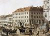
Cheboksary. Travelers sailing down the Volga in the 19th century always stopped their eyes on a small town perched on a steep, low bank. Cheboksary is an ancient and very rich city in the past, famous for its abundance of churches and the ringing of bells. “Churches and houses in half,” the Ukrainian poet Taras Grigorievich Shevchenko said about him. In the guidebooks of the 19th century. the city was called "the capital of the Chuvash kingdom." Now it is the capital of the Chuvash Republic - the only one in the Volga region where the indigenous population (Chuvash) constitutes the absolute majority.
According to folk legend, in ancient times there was a village on the site of the city. The Chuvash Shupakshar lived in it, who gave his name to the river that flowed nearby. In Russian pronunciation, the river, and then the city, began to be called Cheboksary. It is based on the Chuvash word “shor” - “swamp, water, mud.” During excavations, not only wooden residential buildings were discovered, but also tiles indicating the existence of brick buildings. The urban character of the ancient settlement is confirmed by the remains of various craft industries: blacksmithing, locksmithing, jewelry, leatherworking, shoemaking, and pottery.
The first historically reliable mentions of Cheboksary in Russian sources date back to 1371. They are associated with the journey of Prince Dmitry Donskoy to the Horde. In 1555, to pacify the local peoples, the Russian government founded a fortress on the right bank of the Volga.
In 1781 Cheboksary became a district town. By this time there were more than a thousand merchants and artisans here, and there was a customs office. However, Cheboksary gradually turned into an ordinary province, unable to withstand competition with its neighbors - Nizhny Novgorod and Kazan. In 1897, there was no longer a single plant or factory left in the city, not a single fair was held.
In Soviet times, having become the capital of the Chuvash Republic, Cheboksary gained a second youth. The city grew, was built up with modern buildings, and was decorated with monuments (including to the hero of the civil war Vasily Ivanovich Chapaev, who came from the village of Budaiki, which was included within the city limits). In modern Cheboksary there are many enterprises, the leading of which are mechanical engineering and textile. The population of the capital of Chuvashia is 444 thousand people.
Prince Andrei Kurbsky was the first to mention the Chuvash as a separate people in 1552. Some scientists believe that the Chuvash language, which stands alone in the group of Turkic languages, is a direct descendant of the language of the Volga Bulgars. There is no doubt that among the ancestors of the Chuvash there were also local Finnish tribes; It is from them that the current Mari descend.
In terms of culture and traditions, the Chuvash differ little from their neighbors. In their customs, folklore, beliefs, clothing and way of life, stable ties with the Finno-Ugric peoples can be traced; their language is related to the Tatar, and the Chuvash share the same methods of farming with the Russians. Since ancient times they were farmers; already in the Middle Ages they used iron plows adopted from the Bulgars. Travelers in the 19th century. noted that the Chuvash are hardworking; they were considered good, wealthy owners, and there were almost no beggars among them.
In the schools created by the missionaries, intensive teaching of the Russian language took place, which gave many talented Chuvash the opportunity to continue their education. At the same time, missionaries persistently converted the Chuvash to Orthodoxy, and this led to rapid mass Russification and the ousting of the Chuvash language from everyday life.
Kazan. The name of the city Kazan is interpreted in different ways. It is often derived from the combination of words “kaz-gan”, which in Tatar means “deepened”, “dug out”. But it is more likely that Kazan was originally called the river, the current Kazanka.
In the XII-XIII centuries. on the site of the city there was a fortress, which, apparently, was erected during the heyday of Volga Bulgaria. However, for this state, such fortifications, consisting of ditches, ramparts and, most importantly, a white stone wall, are unique. Many features of the Kazan fortress indicate that southern Russian craftsmen participated in its construction.
The founding of the Kazan Khanate is usually dated back to 1445. The disgraced Sarai Khan Olu-Muhammad, who had tried to create an independent state in the Crimea somewhat earlier, took Kazan by storm and made it the capital of a new state in the Middle Volga. Kazan was a mixture of peoples, customs, and religions. This was facilitated by the wealth of the Khanate, its military power, and its convenient geographical location, which allowed for brisk trade with the whole world. Although the traditions were based on the Bulgarian culture, they had already absorbed everything new and foreign.
On October 2, 1552, Kazan fell under the onslaught of Russian troops. The region turned into a province of the Moscow state, but the city still remained the gateway to the East. It became not only the economic, political, and cultural center of the Middle Volga region, but also the main outpost in trade and diplomatic relations between Russia and Central Asia and Siberia.
At the beginning of the 19th century. Kazan was a typical left bank Volga city. Its population was Russian (only 15% Tatars). This is not surprising: after joining Russia, the Tatars were evicted outside the city three times. And each time, the growing Kazan reached a new Tatar settlement and included it within its borders.
The Kazan Kremlin supposedly began to be built in 1555 from the Spasskaya Tower, named after the Church of the Image of the Savior Not Made by Hands located in it. The internal structure of the Kremlin is typical for all similar structures in Russia.
The tower of Khansha Syuyumbeki rises above the entire ensemble; due to its antiquity, beauty, originality of style and abundance of legends associated with it, this is one of the main attractions of Kazan.
After the October Revolution, the city was rebuilt in accordance with the trends of the times. Not only most of the churches and mosques disappeared, but also some local names. Nowadays Kazan, with a population of more than a million people, is the capital of the Republic of Tatarstan. The city has developed many branches of modern industry, primarily metalworking, mechanical engineering, petrochemistry, and light industry. The city is rightfully proud of its cultural and scientific traditions, in particular the famous Kazan University.
Ulyanovsk (Simbirsk). Downstream of the Volga, the right bank gradually rises. The Lobach Mountains, Dolgiye Polyany and then the city of Ulyanovsk (681 thousand inhabitants) appear. Only this city in the Middle Volga region is located on both banks of the river. No one else dared to step across the Volga, especially over the many kilometers long Kuibyshev Reservoir, which was filled in 1957.
The first mention of Simbirsk, in all likelihood, dates back to 1551. Once upon a time there were two villages here - Tatar and Mordovian. The lands in the district belonged to the Tatar Murza Sinbir. This is where the name of the area came from. The Russian fortress, founded in 1648, was initially also called Sinbirsk, and then turned into Simbirsk.
The chosen location was very successful: on the Volga side, a high bank, the yar, rose from the swampy and impassable floodplain. From the north there were deep ravines, along the edges of which additional earthen ramparts were poured. From the west the town was protected by the Sviyaga River. At the very top of the ravine - Ventse - a Kremlin was built. The Simbirsk fortress played an extremely important role in the development of the region. It was erected for protection from the steppe inhabitants, and also “so that all sorts of military people and Cossack thieves would not penetrate Rus' by deception and would not commit any bad things,” as stated in the instructions of Tsar Alexei Mikhailovich. In 1648-1654. the Simbirsk-Karsun serif line (line of defensive structures) was drawn from the city.
However, the convenient position of the fortress turned into a loss for Simbirsk in trade and economic terms: the development of the city was hampered by inaccessibility from the Volga and remoteness from the main grain regions. As a result, Simbirsk was unable to compete with such centers of industry and trade as Kazan and Samara.
Nevertheless, it happened to become a city of big names. The philosopher Vasily Vasilyevich Rozanov considered the city his spiritual homeland. A native of Simbirsk was Vladimir Ilyich Ulyanov-Lenin, in whose honor the city was named Ulyanovsk.
A “noble city” was located on Venets. In this part there were cathedrals, provincial and city institutions, educational institutions, a theater, public gardens and boulevards, and the best hotels. The slopes of the mountain going down to Sviyaga and the Volga were occupied by petty bourgeois settlements.
During Soviet times, the city began to grow in the lowlands. The Zasviyazhye region is located in the floodplain and along the low terraces of Sviyaga.
Samara. After the Sokoliye Mountains, the Volga valley expands sharply, its banks become lower. Samara (over 1 million inhabitants) begins on the left bank almost directly from the water.
Samara is one of the oldest Russian cities in the Middle Volga region, founded in 1588. There is a legend that back in the 14th century there was a settlement of Russian hermits in these places. They were allegedly visited by the famous statesman Metropolitan Alexy on one of his trips to the Golden Horde and predicted the emergence of a large city.
Unlike other Middle Volga cities, the Samara fortress stood in close proximity to the steppe. The border situation was the main reason for the creation of customs here. This strengthened the role of the city after the creation of transportation across the Volga. In 1688 Samara received the title of city. Of considerable importance in transforming a nondescript provincial town into one of the most important shopping centers in Russia was the railroad running through Samara, connecting the central regions of Russia with the southeastern ones.
During Soviet times, Samara, renamed Kuibyshev in 1935 in honor of one of the state figures, became the largest industrial center of the Volga region. Manufacturing giants acted as magnets around which urban areas were formed. The center remains of the old buildings; The only enterprises here are a brewery (where the famous Zhigulevskoe beer brand came from) and the Rossiya confectionery factory.
In the northern part of Samara there is an automotive and tractor electrical equipment plant (KATEK) - the brainchild of the first five-year plan (1928-1933). The Oktyabrsky district of the city grew around the plant on the high Volga bank. In another district, Krasnoglinsky, building materials are produced from local raw materials. The eastern districts of the city were formed during the war years, when many industrial enterprises, including metallurgical and aviation, were evacuated from the western regions of the country to Kuibyshev. The southern quarters of Samara are united around an oil refinery.
ZAVOLZHIE
Undermining the steep right bank and moving west, the Volga leaves behind a low-lying plain in the east - the so-called Low Trans-Volga region. Before the arrival of the Russians, it was one of the most densely populated areas of both Volga Bulgaria and the Kazan Khanate. The Russians were moving here from the west. And today Russian villages are located along the Volga, and Tatar ones are located at a distance from it. In addition, in the east of the Low Volga region there are many Chuvash and Mordovian villages. They were founded by settlers from the Volga region who fled serfdom. Low Trans-Volga region is a pronounced agricultural province. The villages, evenly distributed throughout the territory, are growing in breadth, occasionally stretching along small valleys, highways and railways. One of the large settlements gave rise to the only city here, Melekess, which was later renamed Dimitrov-grad. Its industry is focused mainly on the processing of agricultural raw materials. However, the city is also known as one of the centers of nuclear research.
The Middle Volga region is one of those few regions of the Russian Federation in which the positive aspects of market reforms of the last decade of the 20th century were clearly manifested. The largest enterprises in the new economic conditions were able to confirm their competitiveness, and the population began to actively and quite successfully look for points of application of initiative. Perhaps this is explained by the relative youth of the region, which was developed relatively late and has not lost its dynamism.
Astrakhan, Volgograd, Penza, Samara, Saratov, Ulyanovsk regions. Republics of Tatarstan and Kalmykia.
Economic and geographical location.
The Volga region stretches for almost 1.5 thousand km along the Volga from the confluence of the left tributary of the Kama to the Caspian Sea. Territory - 536 thousand km 2.
The EGP of this area is extremely profitable. The Volga region directly borders the highly developed Volga-Vyatka, Central Black Earth, Ural and North Caucasus economic regions of the Russian Federation, as well as Kazakhstan. A dense network of transport routes (railway and road) contributes to the establishment of broad inter-district production connections in the Volga region. The Volga-Kama river route gives access to the Caspian, Azov, Black, Baltic, and White seas. The presence of rich oil and gas fields and the use of pipelines passing through this area also confirm the profitability of the area's EGP.
Natural conditions and resources.
The Volga region has favorable natural conditions for living and farming. The climate is temperate continental. The area is rich in land and water resources. However, in the lower Volga region there are droughts, accompanied by dry winds that are destructive to crops.
The relief of this area is varied. The western part (the right bank of the Volga) is elevated, hilly (the Volga Upland passes into low mountains). The eastern part (left bank) is a slightly hilly plain.
Natural and climatic conditions, terrain and the large extent of the region in the meridional direction determine the diversity of soils and vegetation. In the latitudinal direction from north to south, natural zones successively replace each other - forest, forest-steppe, steppe, then giving way to sultry semi-deserts.
The area is rich in mineral resources. They extract oil, gas, sulfur, table salt, and raw materials for the production of building materials. Until the discovery of oil fields in Western Siberia, the Volga region held first place in terms of oil reserves and production in the country. Currently, the region ranks second in the extraction of this type of raw material after West Siberia. The main oil resources are located in Tatarstan and the Samara region, and gas resources in the Saratov, Volgograd and Astrakhan regions.
Population.
The population of the Volga region is 16.9 million people. The average population density is 30 people per 1 km 2, but it is unevenly distributed. More than half of the population is in the Samara, Saratov regions and Tatarstan. In the Samara region, the population density is the highest - 61 people per 1 km 2, and in Kalmykia - the minimum (4 people per 1 km 2).
Russians predominate in the national structure of the population. Tatars and Kalmyks live compactly. The share of Chuvash and Mari among the residents of the region is noticeable. The population of the Republic of Tatarstan is 3.7 million people. (among them Russians - about 40%). About 320 thousand people live in Kalmykia. (the share of Russians is more than 30%).
The Volga region is an urbanized region. 73% of all residents live in cities and urban-type settlements. The overwhelming majority of the urban population is concentrated in regional centers, capitals of national republics and large industrial cities. Among them, the millionaire cities of Samara, Kazan, and Volgograd stand out.
Farming.
In terms of the level of development of a number of industries, the region is not much inferior to highly industrialized regions, such as Central and Ural, and in some cases even surpasses them. This is one of the leading areas of the oil production, oil refining and petrochemical industries. The Volga region is the largest region of diversified agriculture. The region accounts for 20% of the gross grain harvest. The Volga economic region is distinguished by its great activity in foreign economic relations of Russia.
The main branches of industry specialization in the Volga region are oil and oil refining, gas and chemical, as well as electric power, complex mechanical engineering and the production of building materials.
The Volga region ranks second in Russia after the West Siberian economic region in oil and gas production. The amount of extracted fuel resources exceeds the needs of the region. The favorable transport and geographical position of the region led to the emergence of a whole system of main oil pipelines running both in the western and eastern directions, many of which are now of international importance.
The formation of a new oil base in Western Siberia changed the orientation of the main oil flows. Now the Volga region pipelines are “turned” entirely to the west.
The region's oil refineries (Syzran, Samara, Volgograd, Nizhnekamsk, Novokuybyshevsk, etc.) process not only their own oil, but also the oil of Western Siberia. Refineries and petrochemicals are closely related. Along with natural gas, associated gas is extracted and processed, which is used in the chemical industry.
The chemical industry of the Volga region is represented by mining chemistry (extraction of sulfur and table salt), chemistry of organic synthesis, and polymer production. The largest centers: Nizhnekamsk, Samara, Kazan, Syzran, Saratov, Volzhsky, Tolyatti. In the industrial hubs of Samara - Togliatti, Saratov - Engels, Volgograd - Volzhsky, energy and petrochemical production cycles have developed. They are geographically close to the production of energy, petroleum products, alcohols, synthetic rubber, and plastics.
The development of the energy, oil and gas and chemical industries accelerated the development of mechanical engineering in the area. Developed transport connections, the availability of qualified personnel, and proximity to the Central region necessitated the creation of instrument and machine tool factories (Penza, Samara, Ulyanovsk, Saratov, Volzhsky, Kazan). The aircraft industry is represented in Samara and Saratov. But the automotive industry especially stands out in the Volga region. The most famous are the factories Ulyanovsk (UAZ cars), Tolyatti (Zhiguli), Naberezhnye Chelny (KAMAZ trucks), Engels (trolleybuses).
The food industry remains important. The Caspian Sea and the mouth of the Volga are the most important inland fishing basin in Russia. However, it should be noted that with the development of petrochemistry, chemistry and the construction of large engineering plants, the ecological condition of the Volga River has sharply deteriorated.
Agro-industrial complex.
In the region, located in forest and semi-desert natural zones, the leading role in agriculture belongs to livestock farming. In the forest-steppe and steppe zones - crop production.
It is the regions of the Middle Volga region that have the highest arable land (up to 50%). The grain region is located approximately from the latitude of Kazan to the latitude of Samara (rye and winter wheat are grown). Plantings of industrial crops are widespread; for example, mustard crops account for 90% of the crops of this crop in Russia. Livestock farming for meat and dairy production is also developed here.
Sheep breeding farms are located south of Volgograd. In the area between the Volga and Akhtuba rivers, vegetables and melons, as well as rice, are grown.
Fuel and energy complex.
The region is fully supplied with fuel resources (oil and gas). The energy sector of the region is of national importance. The Volga region specializes in the production of electricity (more than 10% of all-Russian production), which it supplies to other regions of Russia.
The basis of the energy sector is the Volzhskaya-Kama cascade hydroelectric power stations (Volzhskaya near Samara, Saratovskaya, Nizhnekamskaya, Volzhskaya near Volgograd, etc.). The cost of energy generated at these hydroelectric power stations is the lowest in the European part of the Russian Federation.
Numerous thermal stations located in cities where oil refining and petrochemical industries are developed use local raw materials (fuel oil and gas). The share of thermal stations in the total electricity production is approximately 3/5. The largest thermal station in the region is the Zainskaya State District Power Plant in Tatarstan, which runs on gas.
The Balakovo (Saratov) NPP is also operational.
Transport.
The transport network of the region is formed by the Volga and the roads and railways crossing it, as well as a network of pipelines and power lines. The Volga-Don Canal connects the waters of the largest rivers in the European part of Russia - the Volga and Don (exit to the Sea of Azov).
Oil and gas from the region are supplied through pipelines to the regions of Central Russia and to countries of the “near” and “far” abroad. The Druzhba oil pipeline system is of international importance - from Almetyevsk through Samara, Bryansk to Mozyr (Belarus), then the oil pipeline branches into 2 sections: the northern one - through the territory of Belarus, then to Poland, Germany and the southern one - through the territory of Ukraine, then to Hungary, Slovakia. The oil pipeline has a branch - Unecha-Polotsk-Ventspils (Lithuania), Mazeikiai (Latvia)
Welcome!
You are on the main page Encyclopedias of Nizhny Novgorod- the central reference resource of the region, published with the support of public organizations of Nizhny Novgorod.
At the moment, the Encyclopedia is a description of regional life and the external world surrounding it from the point of view of the Nizhny Novgorod residents themselves. Here you can freely publish informational, commercial and personal materials, create convenient links like this and add your opinion to most existing texts. The editors of the Encyclopedia pay special attention to authoritative sources - messages from influential, informed and successful Nizhny Novgorod people.
We invite you to enter more Nizhny Novgorod information into the Encyclopedia, become an expert, and, possibly, one of the administrators.
Principles of the Encyclopedia:
2. Unlike Wikipedia, the Nizhny Novgorod Encyclopedia can contain information and an article about any, even the smallest Nizhny Novgorod phenomenon. In addition, scientificity, neutrality, and the like are not required.
3. Simplicity of presentation and natural human language are the basis of our style and are strongly encouraged when they help convey the truth. Encyclopedia articles are designed to be understandable and bring practical benefit.
4. Different and mutually exclusive points of view are allowed. You can create different articles about the same phenomenon. For example, the state of affairs on paper, in reality, in the popular narrative, from the point of view of a certain group of people.
5. Reasoned popular speech always takes precedence over administrative-clerical style.
Read the basics
We invite you to write articles about Nizhny Novgorod phenomena that you think you understand.
Project status
The Nizhny Novgorod Encyclopedia is a completely independent project. ENN is funded and supported exclusively by private individuals and developed by activists on a non-profit basis.
Official contacts
Non-profit organization " Open Nizhny Novgorod Encyclopedia» (self-proclaimed organization)